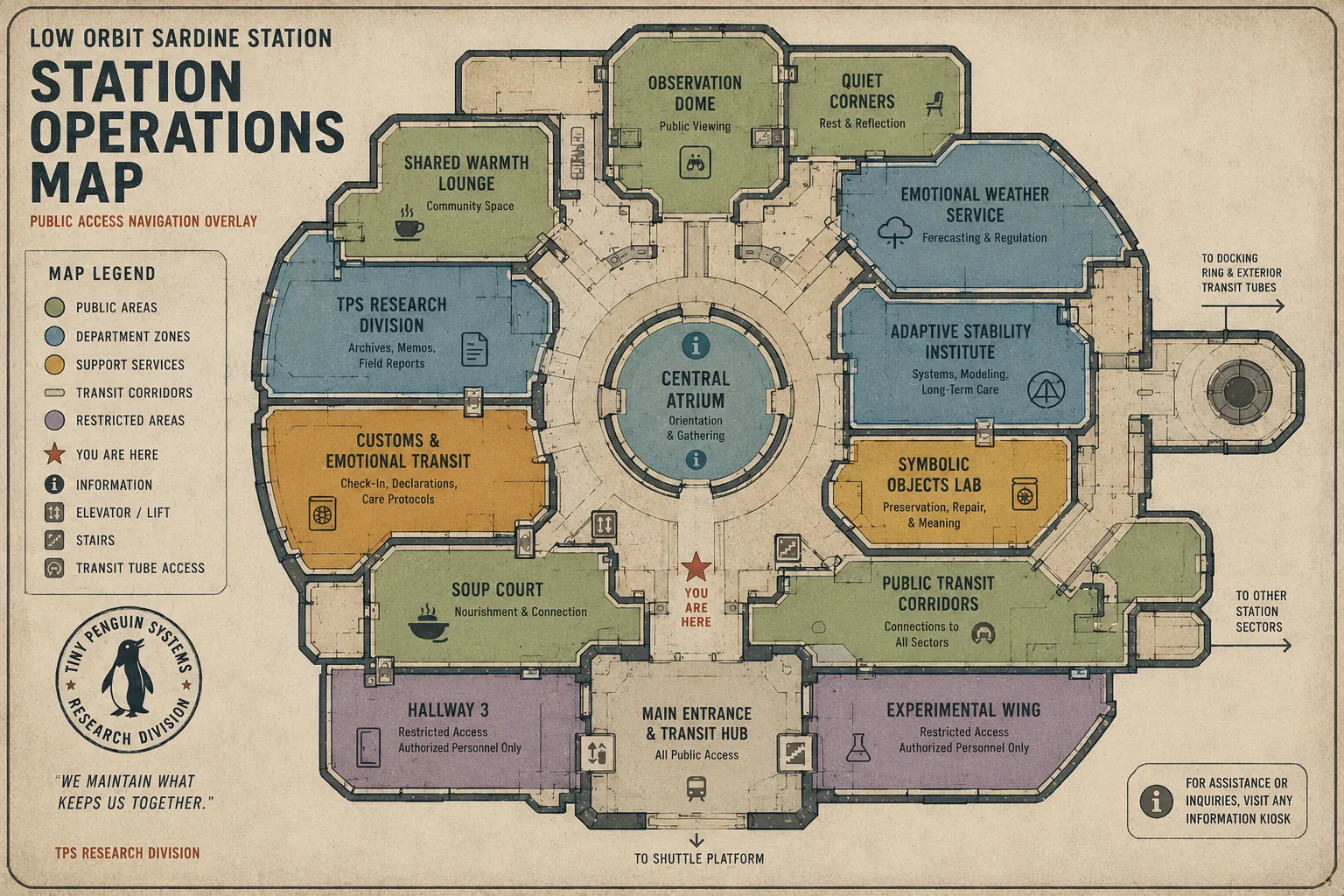
Public Access Cartography
Draws the routes everyone is allowed to use. Updates the overlay whenever a corridor renames itself.
Tiny Penguin Systems Research Division
You Are Here. Probably.
Maps, navigation overlays, and corridors that mostly behave.
We chart Low Orbit Sardine Station: its public routes, its service corridors, and the handful of passages that move when no one is looking. Our maps are accurate at the moment of printing and aspirational thereafter.
Draws the routes everyone is allowed to use. Updates the overlay whenever a corridor renames itself.
Tracks the back passages. Some are for maintenance. Some are for sliding. We log both honestly.
Maintains the arrows. Replaces the ones that point at walls. It is ongoing work.
Notes which passages have quietly relocated. Reassures everyone that this is normal. (It is not. But it is fine.)
Confirms, daily, that the station is still in low orbit and still soup-adjacent.
Reunites confused travelers with their destinations. Hot tip: follow the soup smell.